GIS or geographical information systems are computer-based tools that help to store, capture, check, and display data. Here are the top 10 Geographical Information Systems.
1. Google Maps
Google Map is a consumer application platform operated by Google. It offers satellite-captured photographs, a wide-angle view of street maps, data visualization, and a traffic analyzer system. This system helps to update the mapping service across the globe. Google map indicates traffic conditions for various means of transportation. Google Maps is a desktop-based program.

2. QGIS
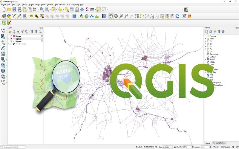
QGIS is user-friendly open-source software that enables us to edit, analyze and visualize data on various operating devices. It supports different types of functional databases. QGIS allows innovation and invention that helps in editing tools used to label and blend cartography.
3. ArcGIS
ArcGIS allows the mapping of critical data for geographic purposes. ArcGIS analyze and visualize data in the form of dashboards and reports. ArcGIS uses an application that helps to analyze data and algorithms. Location monitoring is one of the features of ArcGIS software.
4. Maptitude
Maptitude is software that analyzes various tools, maps, and demographic data. It helps to visualize geographic unearthing more broadly. It is budget-friendly that helps to analyze data with different packages. It serves high performance, including creating, editing, and adding graphical data.
5. GeoServer
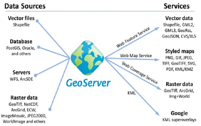
GeoServer is an open-source server that shares geographical data with its users. It handles raster and vector datasets along with the map layer. It implements high-quality map image that is useful in delivering map-related services. GeoServer allows sharing and guides the editing process for various geographical data.
6. SAGA GIS
SAGA GIS stands for system Automated Geoscientific Analysis. It Is a User-friendly GIS software that provides Application Programming Interface (API). It Is a set of geoscientific tools that allows exchanging Module Libraries. SAGA helps in 3D rendering analytic tools and is Powerful for terrain and raster data. It Is a Geostatistic Command-line interpreter tool that has a GPL license.
7. Google Earth Pro
Google Earth Pro is a user-friendly geographic browser that allows one to visualize, overlay, assess, and create geospatial data. They provide various processes and tools to obtain high-resolution aerial images. Google Earth Pro helps to find locations for uploading or downloading geospatial data. Google Earth displays ocean topography and other geographic data to represent the Earth as a 3D globe.
8. Microsoft Bing
Microsoft Bing chatbot runs on OpenAI large language model (LLM) that helps to customize search results from the web. Microsoft Bing provides easy access to quality content. It supports API accessibility for walking, driving, and public transportation. The Routing API allows data trafficking to ensure a fast and safe route. The API enables maps to access across multiple platforms such as Web APIs, Bing Maps REST Services, the Bing Spatial Data Services, and Bing Maps WPF Control SDK.

9. Global Mapper
Global Mapper is a GIS analyzer that provides flexibility. It has a 64-bit application display for LiDAR and elevation. Global Mapper allows geospatial professionals and data processing tools. It uses a logical layout to ensure a better learning experience. The significant roles of Global Mapper are map creation, optimized data processing, and management.
10. GRASS GIS
GRASS GIS is an open-source geoprocessing tool that improves interface and map projects. The top features of GRASS GIS are LiDAR and network analysis, extensive documentation and tutorials, better satellite imagery tool, 3D raster rendering and customization, vector, imagery, and temporal tools.
